Date: 03/28/2015
Who: Sammy and myself
Length: about 12.0 miles
Time: 6 hours
Weather: about 75 degrees, sunny
Browns Canyon National Monument is a new national monument designated by presidential proclamation just last month. The Friends of Browns Canyon website has information and maps for visitors.
We camped two nights at Ruby Mountain campground (site #3) in the Arkansas Headwaters Recreation Area. This campground is walking distance to the trailhead for the national monument. The campground is very basic with no water (other than the river), no electricity, and no dumpster for trash. Nevertheless, I would stay there again. The sites are dispersed, and views of the Collegiate Peaks and Arkansas River are excellent.
For our day-hike, we hiked the Turret trail and Catkin Gulch Loop trails. The area offers views of the Sangre de Cristo mountains to the south, Mt. Ouray and Mt. Chipeta to the southwest, Mt. Shavano, Mt. White, Mt. Antero, Chalk Cliffs, Mt. Princeton, Mt. Yale, and Mt. Columbia to the west. On these trails, there were many times when I was compelled to just stop and attempt to absorb the beautiful scenery visible in every direction.
The trail system itself in this area seems relatively undeveloped. This is not surprising, since it’s a new national monument and was previously a wilderness study area. A good amount of the trails follows dry stream beds. And, it’s not always clear where exactly to exit the stream beds in order to get back onto the hiking trail. Catkin Gulch Loop actually leaves the national monument and enters the San Isabel National Forest for its easternmost section. I lost the trail twice in the Catkin Gulch Loop area, but found my way back using the topographical map and landmarks. Because of the difficult route-finding and distance, I’d rate this trail system medium-to-difficult. Remember to take plenty of water if hiking Catkin Gulch–the Arkansas River is not that close.
This is a great option for an off-season camp/hike. Ruby Mountain campground is low elevation and open year round. We encountered next to no snow on the hike, even though it’s early spring. The Arkansas River valley is known for mild winters.
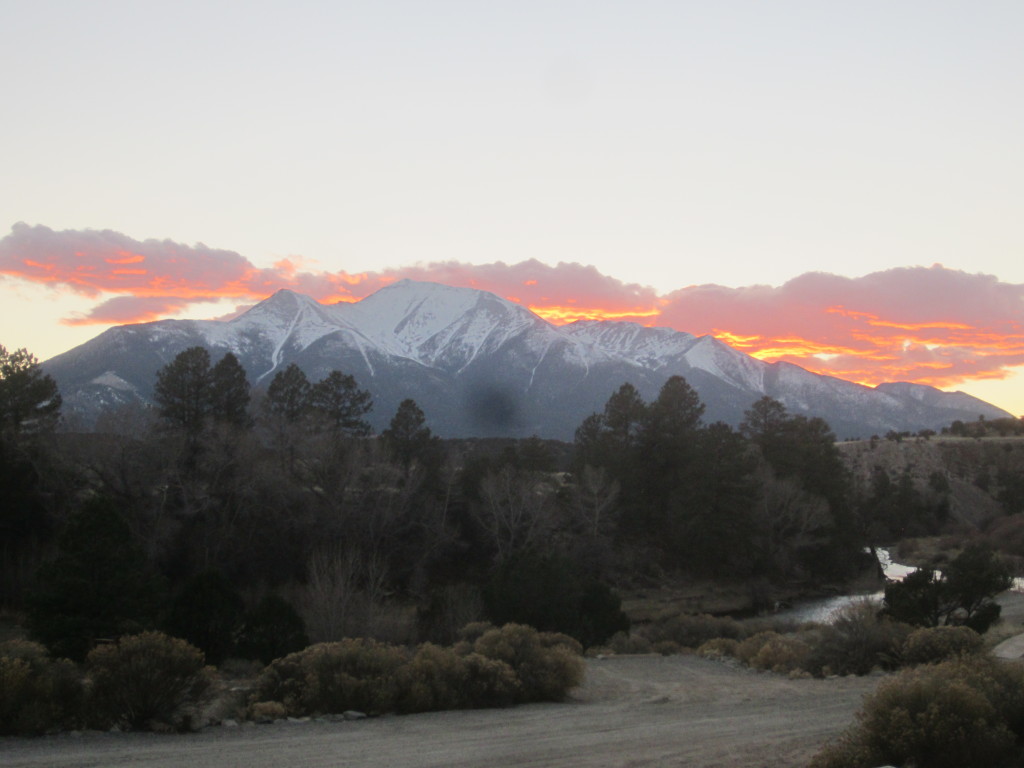
Mt. Princeton, a few minutes after sunset, viewed from Ruby Mtn. Campground:

This hike followed the BLUE line:
View Colorado Chris Hikes in a larger map

Looks like a great hike with wonderful scenery. Love your new sunset masthead..gorgeous. Did you take the pop up? How did you sleep? Thanks for the post and letting us flat landers hike with you.
Wow, what a gorgeous photo! Amazingly beautiful, can imagine the in person experience was much better even. Watched the vido with the kids, FKH enjoys seeing Sammy and CKH likes hearing the narration. The Arkansas River connection was fun. Glad you showed us this new National Monument, & that while you were wandering you didn’t really get lost 😉 The orienteering skills in this one are strong…ummm…yes, strong are they…ummmm.